How we make this list: we compare pricing pages, product documentation and public user reviews. Rankite is independent; if a vendor ever pays for a featured spot, that listing is clearly labeled Partner.
Key takeaways
- Esri's ArcGIS Urban and CityEngine are the default 3D scenario planning stack for cities already on ArcGIS, while UrbanFootprint leads on data-driven impact analysis.
- Replica and Remix (now part of Via) answer the mobility questions: who moves where, and how transit changes would perform.
- Two familiar names changed hands: Remix now lives under Via's website, and Social Pinpoint redirects to OpenPoint after its acquisition.
- Public engagement is half the purchase: MetroQuest and OpenPoint exist because the best plan fails without community buy-in.
Quick comparison
Is your product missing or out of date?
We review this list regularly. Vendors can request a listing, send updated pricing or ask about featured placement.
The best urban planning software

#1
ArcGIS Urban
Best for: 3D scenario planning for cities
Visit esri.com
Starting priceSee website
Free planNo
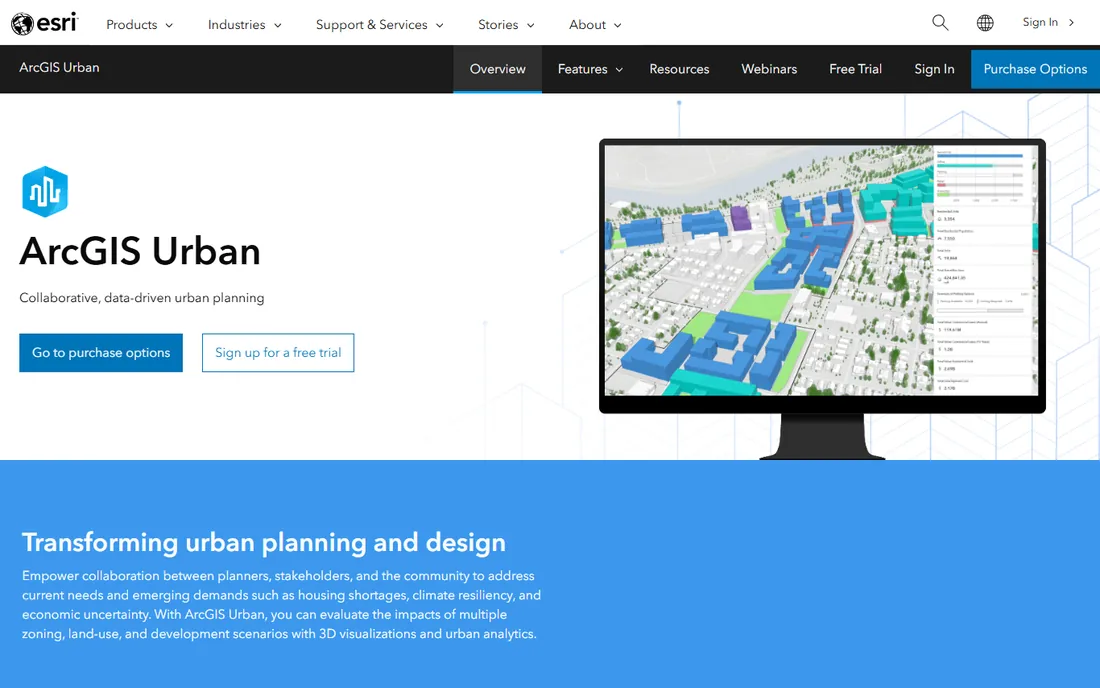
ArcGIS Urban is Esri's answer to the modern planning department: a cloud-based 3D environment where planners test zoning changes, model development scenarios and review projects in the context of the real city. You can adjust land-use rules and immediately see the impact on buildings, capacity and metrics like housing units or jobs. Design review becomes a visual conversation instead of a paper chase.
The platform strength is integration. Because it sits on ArcGIS, the city's existing GIS data, from parcels to infrastructure to demographics, feeds the scenarios directly. Planning teams collaborate in the browser, and the public-facing views help communicate proposals to councils and residents. Cities like Boston have used it to build digital twins that streamline development review.
The honest catch is the ecosystem commitment. ArcGIS Urban makes the most sense for organizations already invested in Esri, and the pricing reflects enterprise GIS. Smaller municipalities without GIS staff will find the learning curve and cost steep. But for a city planning department standardizing on Esri, it is the natural centerpiece.
What we like- Web-based 3D digital twin of the city
- Zoning and land-use scenario tools
- Integrates with the ArcGIS platform
Watch out for- Requires ArcGIS commitment
- Enterprise pricing and implementation
Starting priceSee website
Free planNo
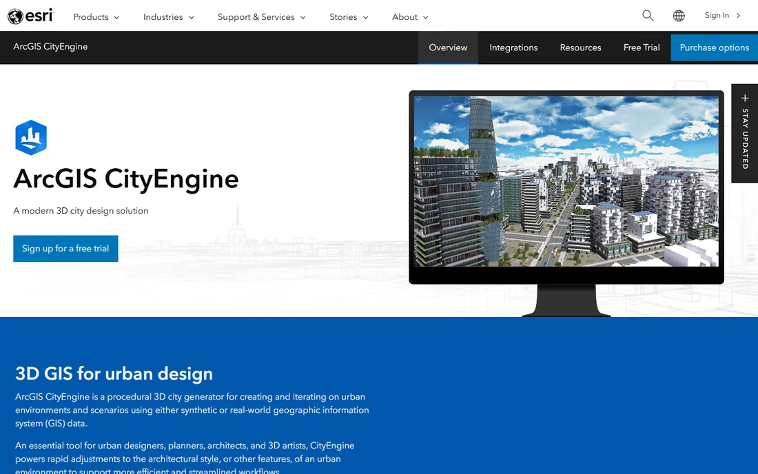
CityEngine is Esri's procedural modeling tool: instead of drawing every building, you write rules and it generates whole districts, streets and skylines in 3D. Urban designers use it to visualize zoning scenarios, test massing options and produce the compelling visuals that win public support. Rule-based reports automatically calculate density, floor area and other metrics as designs change.
The power is in iteration speed. Change the zoning rule and watch the district rebuild itself, with quantities updating live. Scenes publish to the web for stakeholder review, and the standard format exports (FBX, COLLADA, OBJ) feed into rendering and VR pipelines. Game studios and film productions use it too, which keeps the visualization quality high.
The trade-off is specialization. CityEngine is a desktop application with its own rule language, and mastering it takes dedicated effort. It is a design and analysis instrument, not a collaboration platform; pair it with ArcGIS Urban or a web viewer for the public-facing side. For planning teams that need to model and visualize alternatives fast, it earns its keep.
What we like- Generates entire 3D cities from rules
- Powerful for visualization and analysis
- Exports to standard formats
Watch out for- Specialist tool with a learning curve
- Desktop-based workflow
Starting priceSee website
Free planNo
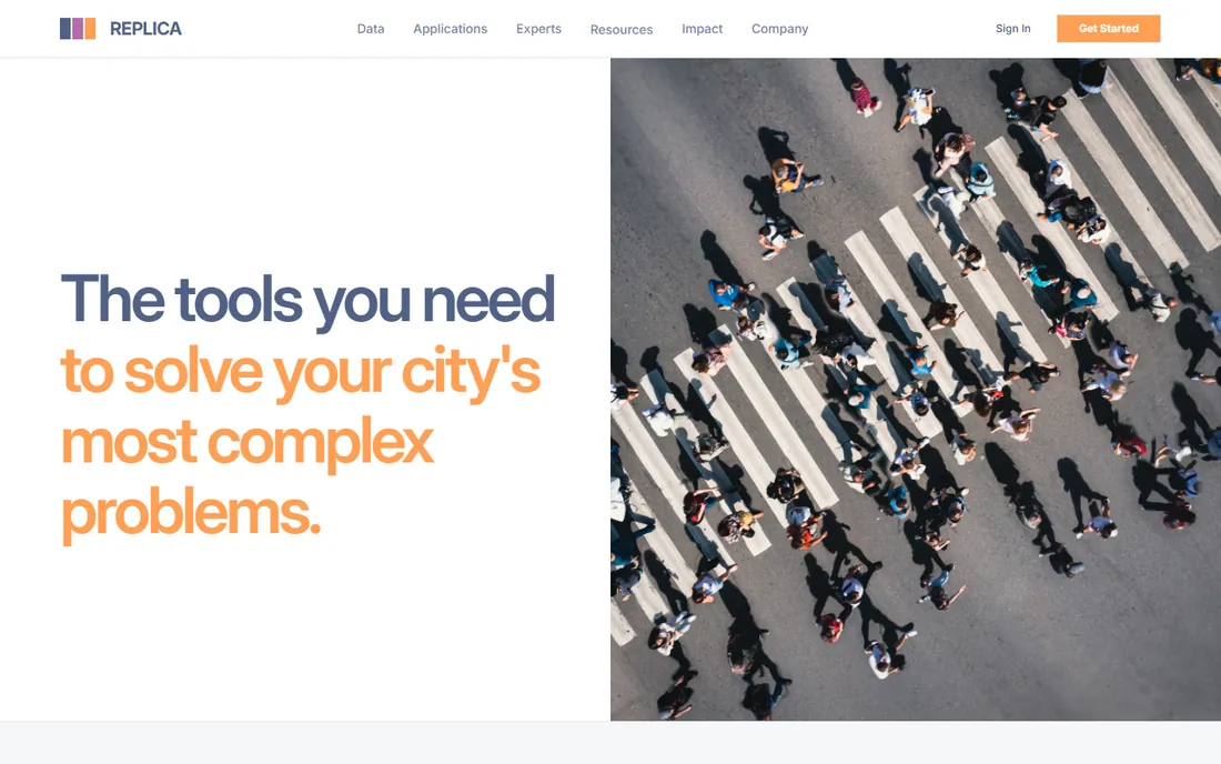
Replica is a data platform that models how people actually move: where they live, work, shop and travel, at census-tract detail across the US. Its activity-based models synthesize mobile location data into representative travel patterns that planners use for transportation planning, economic development and land-use decisions. The MTA and other major agencies use it for high-stakes analysis.
The value is the question it answers. Traditional travel surveys are expensive, slow and small; Replica provides a continuously updated picture of mobility and economic activity that would cost millions to collect directly. Planners test scenarios like transit changes or development impacts against realistic travel behavior.
The catch is that it is a data product, not planning software in the design sense. You analyze in Replica and act in your planning tools. Pricing is enterprise and quote-based, which puts it out of reach for small agencies. For regional planning, transportation agencies and large cities, the insight per dollar is strong.
What we like- Detailed synthetic mobility data nationwide
- Answers who-goes-where questions
- Trusted by major agencies
Watch out for- Data product, not a design tool
- Pricing is enterprise
Starting priceSee website
Free planNo
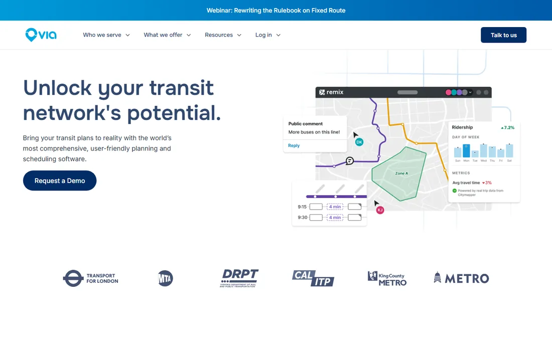
Remix started as the transit planner's sketchbook: draw a bus route on a map and instantly see residents served, costs, frequencies and demographic impacts. Acquired by Via, it now sits within Via's transit technology suite alongside on-demand planning tools that model how flexible services complement fixed routes. Transit agencies use it to design networks, plan service changes and build public consensus.
The workflow advantage is speed and clarity. What took a planner four hours across GIS, spreadsheets and Google Maps now takes 30 minutes in one tool, with trade-offs visible in real time. The street design module helps agencies redesign corridors for buses, bikes and pedestrians. Public-facing views make service changes explainable at community meetings.
The honest framing is the Via ownership. Remix is now sold as part of Via's platform story, which is great for agencies buying into on-demand transit but worth noting for those who just want the planning tool. It is transit-specific; land-use and zoning questions belong in ArcGIS Urban or UrbanFootprint. For transit planning, it remains the category leader.
What we like- Purpose-built transit planning workflows
- Real-time cost and ridership feedback
- Street design tools
Watch out for- Now part of Via's ecosystem
- Focused on transit, not general land use
Starting priceSee website
Free planNo
OpenPoint is the current home of what was Social Pinpoint, the community engagement platform many planning departments know. It provides online surveys, interactive mapping, idea walls and project pages that let residents weigh in on plans from their phones. The redirect from the old domain reflects an acquisition and rebrand, so confirm the current feature set and pricing during evaluation.
The use case is legitimacy. Plans designed without public input face political risk; OpenPoint gives agencies a structured way to collect, analyze and report community feedback. The mapping tools let residents comment on specific locations, which produces more useful input than generic surveys. Integration with planning workflows keeps engagement tied to decisions.
The limitation is scope: this is engagement software, not planning analysis. You still need ArcGIS Urban, UrbanFootprint or similar for the technical work. And given the rebrand, ask pointed questions about the roadmap and support continuity. For the engagement half of planning, it remains a solid choice.
What we like- Purpose-built public engagement for planning projects
- Good survey and mapping tools
- Established user base
Watch out for- Rebranded after acquisition, so verify the current offering
- Engagement-only, not analysis
Starting priceSee website
Free planNo
MetroQuest has run online public engagement for major planning efforts since 1997, from regional transportation plans to city comprehensive plans. Its surveys are visual and interactive: residents prioritize investments, react to scenarios and trade off options in an interface designed for non-planners. Agencies get structured, reportable input instead of a pile of open-ended comments.
The strength is decision-grade feedback. MetroQuest surveys are built around the actual choices a plan must make, so the results inform decisions rather than just measuring sentiment. The reporting tools turn thousands of responses into presentations a council can act on. Hundreds of agencies have used it for high-stakes plans.
The trade-off is the project model. MetroQuest is typically engaged per planning effort rather than as an always-on platform, which suits comprehensive plans and corridor studies better than continuous engagement. Smaller projects may find it more than they need. For the big public decisions, its track record is unmatched.
What we like- Engaging visual surveys for big planning decisions
- Strong track record with agencies
- Good reporting
Watch out for- Project-based pricing
- Focused on major plans, not ongoing engagement
Starting priceSee website
Free planNo
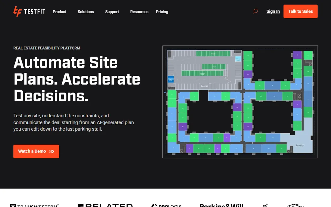
TestFit answers the developer's first question: what can I actually build on this site, and does it pencil out? Drop a parcel into the tool and it generates building massing, unit mixes, parking layouts and pro formas in minutes, constrained by real zoning and construction logic. Architects and developers use it to screen sites and test deals before spending on design.
The speed changes the business. Feasibility studies that took weeks of architect time now take an afternoon, so developers evaluate more sites and kill bad deals earlier. The output is credible enough for early-stage decisions and investor conversations. Multifamily, mixed-use and industrial typologies are covered.
The honest boundary is the audience. TestFit is built for private developers and architects, not for public planning departments writing the zoning it tests. The data and deal logic are US-focused. Planners evaluating development proposals may find it useful to understand the developer's math, but it is not a public-sector planning tool.
What we like- Instant feasibility on real sites
- Developers and architects love the speed
- Handles multifamily and mixed-use
Watch out for- US-focused
- Built for developers, not public agencies

#9
Bentley OpenCities Planner
Best for: infrastructure digital twins
Visit bentley.com
Starting priceSee website
Free planNo
Bentley Systems brings the infrastructure engineering perspective to urban planning. Its OpenCities Planner and broader digital twin platform let cities model transportation networks, utilities and the built environment together, simulating how infrastructure investments perform before they are built. The urban mobility simulation tools model multimodal traffic, pedestrian flows and construction impacts.
The differentiator is engineering depth. Where planning tools sketch scenarios, Bentley's platform connects to the engineering models behind bridges, roads and utilities, so the digital twin reflects how infrastructure actually behaves. Large agencies planning transit corridors, smart city programs and major capital projects use it to coordinate across engineering disciplines.
The catch is enterprise scale. This is serious software with serious pricing and implementation requirements, aimed at agencies and firms running major infrastructure programs. A small city planning department will find it overwhelming. For the infrastructure-heavy end of urban planning, Bentley's modeling heritage is the reason to choose it.
What we like- Deep infrastructure modeling heritage
- Digital twin approach
- Strong for large capital projects
Watch out for- Enterprise complexity and pricing
- Overkill for small planning efforts
What to check before you buy urban planning software
Start by separating three jobs: designing scenarios, analyzing impacts and engaging the public. No single tool does all three well. Most planning departments end up with a design tool (ArcGIS Urban or CityEngine), an analysis tool (UrbanFootprint or Replica) and an engagement tool (MetroQuest or OpenPoint). Buying one tool to do everything is the classic mistake.
Second, audit your data and skills. The Esri tools assume GIS capacity; UrbanFootprint and Replica assume less. Third, check the procurement reality: enterprise planning software is bought through RFPs with implementation services, not credit-card signups. Budget for training and data preparation, not just licenses. Finally, verify geographic coverage. Several tools here are US-centric in their built-in data; international buyers should confirm coverage before committing.
The consolidation nobody talks about
Urban planning software is consolidating fast. Esri keeps absorbing functionality into the ArcGIS platform, Via bought Remix, and Social Pinpoint became OpenPoint under new ownership. Each acquisition changes the roadmap, the pricing and the support experience.
The practical advice is to buy the capability, not the brand, and to get roadmap commitments in writing during procurement. Ask what happens to your data and contracts if the product is merged or sunset. Prefer platforms with open data export over closed ecosystems. And keep the three-job framework in mind: when vendors merge, they usually strengthen one job and neglect the others, which tells you where the gaps in your stack will appear.
How we chose
We compared vendor product pages, planning industry resources and public review sources, then confirmed every homepage was live in October 2026. Remix now redirects into Via's website after the acquisition, and Social Pinpoint redirects to OpenPoint, so we list the current names and URLs and note the changes. Where we could not verify a vendor-published price we say so. Nothing here reflects hands-on testing; assessments come from documentation, feature lists and public user feedback.
Frequently asked questions
What is the difference between ArcGIS Urban and CityEngine?
ArcGIS Urban is a web-based platform for scenario planning and collaboration across a planning department. CityEngine is a desktop tool for procedurally generating detailed 3D city models and visualizations. They complement each other: design and model in CityEngine, plan and collaborate in ArcGIS Urban.
Do small towns need urban planning software?
Most small towns do not need enterprise platforms. The Esri and Bentley tools assume GIS staff and budgets that small municipalities lack. Engagement tools like MetroQuest or OpenPoint can be worthwhile for specific plans, and state or regional agencies sometimes provide analysis support.
How much does urban planning software cost?
Enterprise planning platforms are quote-based and typically run from tens of thousands per year upward, plus implementation. Engagement tools are often priced per project. Always get a quote scoped to your users, data needs and geography.
Can these tools replace public meetings?
No, and they should not. Digital engagement tools extend participation to people who cannot attend meetings, but they complement in-person outreach rather than replacing it. The best-run planning efforts use both.
What data do I need to get started?
It depends on the tool. ArcGIS Urban works best with the city's existing GIS data: parcels, zoning, buildings and infrastructure. UrbanFootprint and Replica bring their own datasets, which is their main selling point. Confirm data coverage for your area during the demo.
Sources we checked (11)
- https://www.esri.com/en-us/arcgis/products/arcgis-urban/overview
- https://www.esri.com/en-us/arcgis/products/arcgis-cityengine/overview
- https://urbanfootprint.com
- https://replicahq.com
- https://ridewithvia.com/solutions/remix
- https://www.openpoint.com
- https://metroquest.com
- https://www.testfit.io
- https://www.bentley.com
- https://slashdot.org/software/comparison/ArcGIS-Urban-vs-UrbanFootprint/
- https://www.route-fifty.com/infrastructure/2021/11/visualizing-data-for-on-demand-transit-planning/316273/?oref=rf-next-story
Is your product missing or out of date?
We review this list regularly. Vendors can request a listing, send updated pricing or ask about featured placement.

Shihab Mia · Founder, Rankite
Shihab has spent more than a decade helping SaaS and e-commerce brands grow through search. He writes Rankite's software buying guides from pricing pages, documentation and public user reviews. More about Shihab.
 CityEngine
 UrbanFootprint
 Replica
 Remix by Via
 OpenPoint
 MetroQuest
 TestFit