How we make this list: we compare pricing pages, product documentation and public user reviews. Rankite is independent; if a vendor ever pays for a featured spot, that listing is clearly labeled Partner.
Key takeaways
- Most earthwork-specific tools are quote-based: AGTEK, Kubla Cubed, InSite, Carlson, and Trimble Business Center do not publish public pricing.
- Kubla Cubed and InSite Elevation Pro are the most approachable picks for estimators who want fast cut-and-fill volumes without a full CAD suite.
- Bluebeam Revu is the budget entry point: it does on-screen takeoff from PDFs but does not build 3D surfaces or compute volumes.
- AGTEK and Trimble Business Center cover the full workflow from takeoff through GPS machine control, which suits contractors running equipment fleets.
Quick comparison
| Tool | Best for | Starting price | Free plan |
|---|
 AGTEK AGTEK | contractors who want takeoff tied to field production | See website | No |
 Kubla Cubed Kubla Cubed | estimators who want quick, accurate volumes | See website | Yes (Lite edition) |
 InSite Elevation Pro InSite Elevation Pro | earthwork and utility takeoff from any data source | See website | No |
 Carlson Carlson | survey and civil firms already working in CAD | See website | No |
 Trimble Business Center Trimble Business Center | contractors with Trimble survey and machine equipment | See website | No |
 Bluebeam Revu Bluebeam Revu | estimators who take off from PDFs on a budget | $260/user/year (Basics) | Free trial (14 days) |
 Autodesk Civil 3D Autodesk Civil 3D | civil engineers who design and estimate from one model | See website | Free trial (30 days) |
Is your product missing or out of date?
We review this list regularly. Vendors can request a listing, send updated pricing or ask about featured placement.
The best earthwork takeoff software
#1
AGTEK
Best for: contractors who want takeoff tied to field production
Visit agtek.com
Starting priceSee website
Free planNo
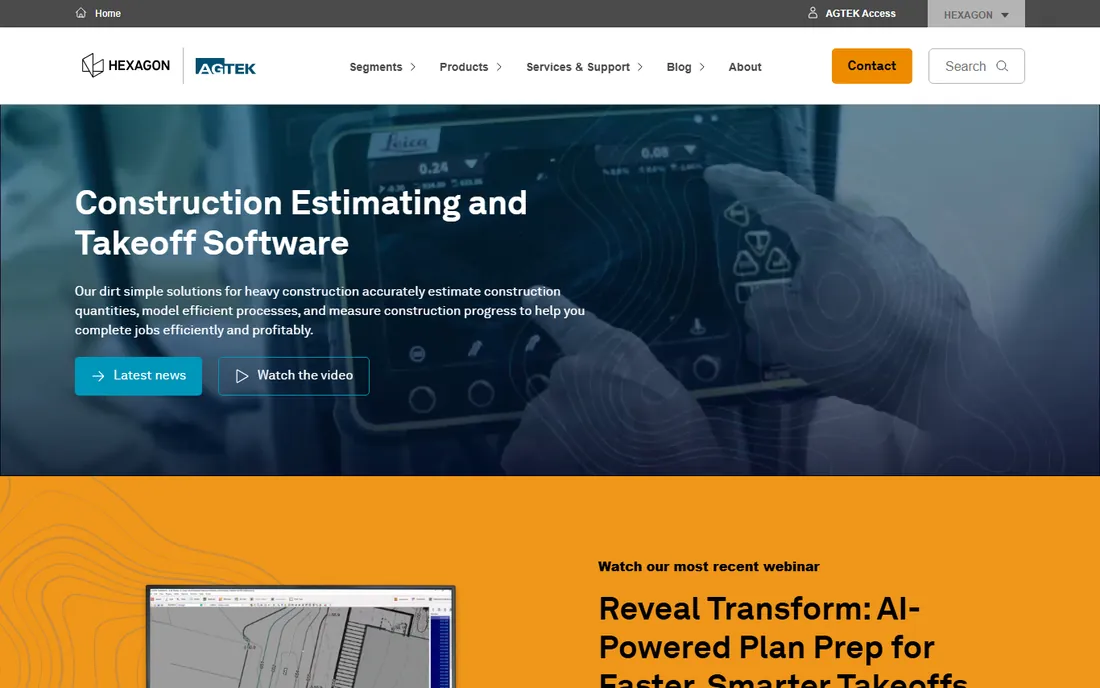
AGTEK is the industry reference point for earthwork takeoff, and its homepage makes no secret of it: 3,500+ customers and 7,600 unique users on its "dirt simple" platform. The product line covers takeoff, 3D modeling, production tracking, and reporting in one workflow. What sets it apart from general CAD tools is the handoff: quantities computed in Gradework feed machine control models, production tracking, and drone-based progress updates. In 2026 the company added Reveal Transform, an AI module that rebuilds PDF plan sheets into CAD-like data for faster takeoff prep.
The catch is access. Pricing is quote-based, and the product assumes you are a working earthwork contractor with survey data and GPS-equipped equipment. An estimator doing occasional commercial takeoffs will find it heavy. But if your crew moves dirt and you want the takeoff, the bid, and the machine model living in the same dataset, AGTEK is the tool everyone else gets compared against.
What we like- Purpose-built for earthwork, not adapted from design software
- Full workflow from takeoff to GPS machine control
- AI plan-prep module to speed data entry
Watch out for- Quote-based pricing
- Aimed at established contractors, not casual estimators
- Learning curve on the full suite
Starting priceSee website
Free planYes (Lite edition)
Kubla Cubed has earned its following by doing one thing well: turning plans, CAD files, and survey points into cut-and-fill volumes fast. The workflow is deliberately simple. Import existing and proposed surfaces, define elements, and the software computes quantities with 3D visualization to back them up. The company also publishes Kubla Cubed Lite, a free edition for basic volume work, which makes it the easiest tool on this list to try before talking to sales.
Where it differs from AGTEK or Trimble is scope. Kubla is an estimation tool, not a production platform. There is no fleet tracking, no machine control modeling, and no field app ecosystem. For estimators at grading and excavation contractors who need defensible numbers by tomorrow, that focus is a feature: the tool is quick to learn and quick to run. Pricing is not published on the homepage, so expect a quote conversation for the Professional edition.
What we like- Simple workflow from plans to cut-and-fill in minutes
- Free Lite edition for basic work
- Popular with smaller contractors and consultants
Watch out for- Focused on volumes rather than full project workflows
- Pricing not published on the homepage
- Less depth for machine control
Starting priceSee website
Free planNo
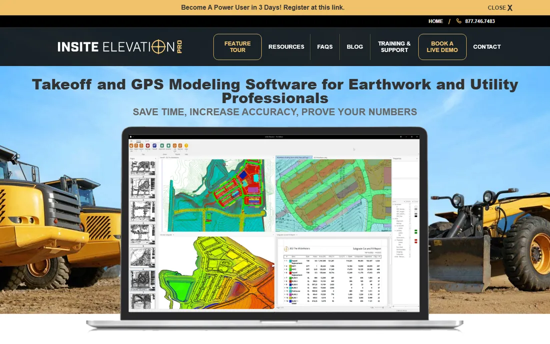
InSite Software has been building earthwork software since 1987, and Elevation Pro reflects that focus. It takes off from PDF, CAD, digitizer, and drone data, computes cut and fill, and adds utility takeoff for storm, sewer, water, and electrical through its TrenchVision 3D feature. One practical strength is output: it exports triangulated surfaces to Topcon, Trimble, CAT, Leica, Komatsu, and other machine control systems, so the takeoff does not dead-end at the bid.
The company emphasizes quantity validation, including a cut-and-fill contour map and grid that estimators can show to back their numbers. That matters because earthwork disputes are usually about quantities, and a visual audit trail wins arguments. InSite is a smaller vendor than Trimble or Autodesk, which cuts both ways: support is personal and construction-specific, but the product roadmap is narrower. Demo pricing is available through their sales team rather than a public price list.
What we like- Takeoff from PDF, CAD, drone, and GPS data
- Utility takeoff with TrenchVision 3D
- Exports machine control models to major systems
Watch out for- Quote-based pricing
- Windows-centric heritage
- Smaller company than the platform giants
Starting priceSee website
Free planNo
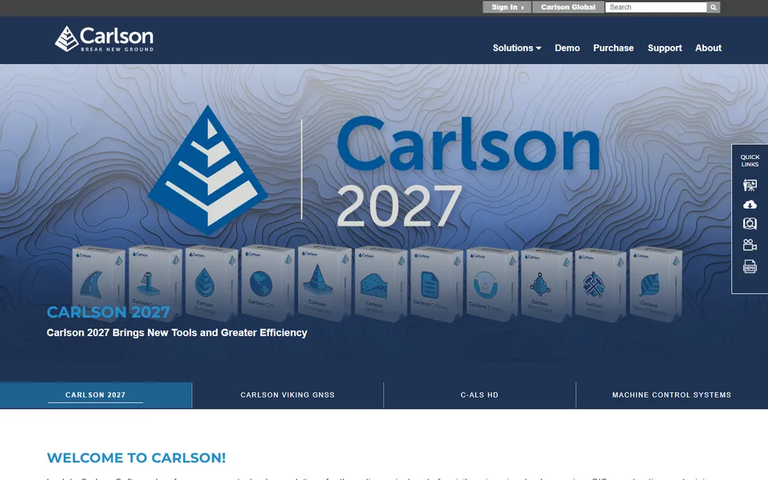
Carlson Software serves civil engineering, surveying, and construction from one CAD-based platform. For takeoff, the relevant product is Carlson Takeoff, which runs in a familiar CAD environment and handles cut-and-fill, surface modeling, and quantity reports. Because Carlson also sells survey and field data collection products, the path from field data to takeoff to design is short. The company just released its Carlson 2027 line in October 2026, so the platform is actively developed.
The trade-off is that Carlson is a CAD product first. Estimators who have never worked in CAD will face a steeper climb than with Kubla or InSite, and choosing among the many Carlson modules takes some guidance. Pricing is not published, so budget conversations start with a dealer. For firms already doing survey or civil design in Carlson, adding Takeoff is the natural move. For pure estimators, the specialist tools are friendlier.
What we like- Native CAD environment for takeoff work
- Tight survey-to-design integration
- Long track record since 1983
Watch out for- Pricing not published
- Broad product line can complicate choosing the right module
- CAD-centric approach has a learning curve
#5
Trimble Business Center
Best for: contractors with Trimble survey and machine equipment
Visit trimble.com
Starting priceSee website
Free planNo
Trimble Business Center is the office hub of the Trimble construction ecosystem. Survey crews, drones, and scanners feed data into TBC, where estimators build surfaces, compute volumes, and prepare models that flow straight to Trimble machine control. For a contractor already running Trimble rovers and GPS-equipped dozers, this is the connective tissue that makes the whole system pay. The takeoff capability is strong, with surface comparison, corridor workflows, and reality-capture updates.
The catch is that TBC is a platform, not a point tool. Buying it just to compute cut and fill is like buying a pickup to carry groceries: it works, but the licensing and learning investment assumes more. Pricing runs through Trimble's distribution partners, and the product is sold in configurations matched to survey, construction, or geospatial work. If your fleet is Trimble, the integration is worth it. If you just need volumes, start with Kubla or InSite.
What we like- Single environment for survey data, takeoff, and machine control
- Strong point cloud and photogrammetry tools
- Works across the whole project lifecycle
Watch out for- Quote-based pricing through distributors
- Heaviest option for a simple takeoff
- Assumes Trimble hardware familiarity
#6
Bluebeam Revu
Best for: estimators who take off from PDFs on a budget
Visit bluebeam.com
Starting price$260/user/year (Basics)
Free planFree trial (14 days)
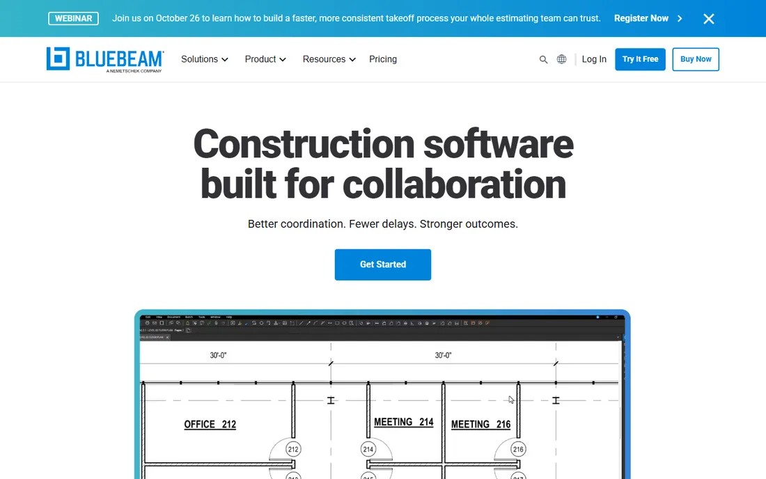
Bluebeam Revu is not earthwork software in the strict sense, and that honesty is part of its appeal. It is a PDF markup and measurement tool that contractors use for on-screen takeoff: lengths, areas, counts, and cutoffs marked up directly on plan sheets, with all measurements exportable to CSV for Excel. For estimators who receive PDFs and need quantities without building 3D models, it is fast and cheap. The Basics plan starts at $260 per user per year, with a 14-day trial available.
What it cannot do is compute cut and fill. Revu measures what you draw on flat sheets; it does not build existing and proposed surfaces or reconcile volumes between them. That limits it to quantity extraction rather than true earthwork takeoff. Many estimators pair Revu with a volume tool: take off in Revu, model in Kubla or AGTEK. As a standalone, it fits estimators doing commercial takeoffs, plan review, and bid comparisons more than graders bidding dirt work.
What we like- Lowest entry price on this list
- Familiar PDF markup workflow
- Exports measurements to CSV for Excel
Watch out for- No 3D surface modeling or volume computation
- PDF-only workflow
- Measurement accuracy depends on drawing quality
#7
Autodesk Civil 3D
Best for: civil engineers who design and estimate from one model
Visit autodesk.com
Starting priceSee website
Free planFree trial (30 days)
Civil 3D is the civil engineering industry's standard design tool, and its takeoff capability comes free with the territory: when the grading, corridors, and surfaces are already in the model, earthwork quantities fall out of it. Surveyors and civil firms use it to build existing and proposed surfaces, run volume computations, and produce construction documents from the same dataset. The 30-day trial lets firms evaluate before committing to a subscription.
The limitation is fit. Civil 3D is design software that happens to take off, not takeoff software designed for estimators. A grading contractor's estimator will spend months learning corridors, styles, and surface analysis before the takeoff feels fast. Subscription pricing reflects the platform's breadth, not a takeoff-only price. If your office already designs in Civil 3D, doing takeoff there is efficient. If you are an estimator choosing a tool for the first time, the specialist products get you productive faster.
What we like- Industry-standard civil design platform
- Takeoff flows from the design model itself
- Huge training and support ecosystem
Watch out for- Subscription pricing is expensive for takeoff-only use
- Steep learning curve
- Overkill if you do not do design
What to check before you buy takeoff software
Start with your data sources. If your plans arrive as PDFs and you have no survey department, pick a tool that excels at PDF and CAD import: Kubla Cubed, InSite, or AGTEK. If you own survey equipment or fly drones, choose software that consumes point clouds and builds surfaces natively: Trimble Business Center, AGTEK, or Civil 3D. The wrong choice here means fighting the tool on every project.
Next, decide where your takeoff ends. If the bid is the finish line, a pure takeoff tool is enough. If your models also feed machine control, GPS layout, or production tracking, you need a platform with that handoff: AGTEK, Trimble, or Carlson. Paying for the full platform when you only bid work is wasted money; picking a point tool when your field crew needs models is a bottleneck.
Finally, count the real users. Takeoff software is priced per seat or per quote, and one estimator's license is cheap compared to the bid value it protects. An estimator error on a 100,000-yard job can erase the entire margin. Trial periods are the cheapest due diligence available: Kubla's Lite edition is free, Bluebeam and Civil 3D offer trials, and the quote-based vendors will demo on your own data. Run your last lost bid through two tools and compare both the numbers and the time it took.
Why earthwork bids live or die on data quality
A joint Autodesk and FMI study found that poor project data and miscommunication are responsible for 52 percent of all rework in US construction. Earthwork is where bad data bites first. A missed topsoil depth, a misread contour, or an unbuildable subgrade assumption flows straight into the bid, and unlike a mispriced door, a dirt error scales with every yard moved.
This is why takeoff tools matter more than their price tags suggest. The difference between on-screen PDF measurement and true surface-based takeoff is the difference between guessing from flat sheets and computing from modeled terrain. Bluebeam covers the first; AGTEK, Kubla, InSite, Carlson, Trimble, and Civil 3D cover the second. Whichever you choose, the discipline is the same: import real data, model both surfaces, validate the quantities, and document how you got them. The contractor who can prove the number usually keeps the margin.
How we chose
We compared specialist earthwork takeoff products against the general CAD and PDF tools estimators actually use, drawing on vendor product pages, documentation, and public reviews on G2, Capterra, and contractor forums like Reddit. We prioritized tools that compute earthwork quantities from real data sources, whether PDF, CAD, survey, or drone, and we weighted workflow fit for estimators at small and mid-size US contractors rather than design firms or enterprise IT. Pricing is quote-based for most of this category, so we noted that honestly instead of repeating reseller numbers. No hands-on testing was performed; our assessments reflect documented features, published pricing, and what working estimators say about each product.
Frequently asked questions
What is earthwork takeoff software?
Earthwork takeoff software calculates the quantities of material that must be moved on a construction site: cut and fill volumes, topsoil strip, subgrade adjustments, and related items. It works from PDF plans, CAD files, survey data, or drone imagery to produce the quantities estimators use to build bids. True takeoff tools model existing and proposed surfaces; simpler tools just measure areas and lengths on flat drawings.
Do I need 3D modeling for earthwork takeoff?
For accurate volumes, yes. Area and length measurements from PDFs cannot reconcile cut and fill between existing and proposed terrain. Tools like AGTEK, Kubla Cubed, InSite, Carlson, Trimble Business Center, and Civil 3D build both surfaces and compute the difference. Bluebeam Revu is useful for quantity extraction but does not compute volumes.
How much does earthwork takeoff software cost?
Most specialist tools in this category use quote-based pricing through the vendor or distributors. Bluebeam Revu is the exception with public pricing starting at $260 per user per year for the Basics plan. Kubla Cubed offers a free Lite edition. Expect specialist takeoff platforms to run into four figures per seat per year, though vendors rarely publish the numbers.
What is the easiest earthwork takeoff software to learn?
Kubla Cubed is widely considered the fastest to pick up, with a focused workflow from plans to cut-and-fill volumes and a free Lite edition to practice on. InSite Elevation Pro is also built for estimators rather than CAD operators. AGTEK, Trimble Business Center, and Civil 3D are more powerful but demand more training time.
Can I do earthwork takeoff with just Bluebeam?
You can take off quantities like areas, lengths, and counts in Bluebeam Revu, and export them to Excel. What you cannot do is compute earthwork volumes, because Revu does not model surfaces. Many estimators use Bluebeam for plan markup alongside a dedicated volume tool for the actual cut-and-fill computation.
What is the difference between takeoff software and machine control?
Takeoff software computes quantities for bidding and planning. Machine control uses those quantities and the underlying surface models to guide GPS-equipped equipment in the field. Tools like AGTEK and Trimble Business Center span both, letting one model serve the bid and the dozer. Point tools like Kubla stop at the takeoff.
Sources we checked (9)
- https://agtek.com/
- https://kublasoftware.com/
- https://insitesoftware.com
- https://carlsonsw.com/
- https://trimble.com/
- https://bluebeam.com/
- https://www.autodesk.com
- https://acppubs.com/BE/article/9DF8527D-poor-project-data-and-miscommunication-responsible-for-52-percent-of-all-rework
- https://techdows.com/download-bluebeam-revu-for-pc-windows-11-10-mac.html
Is your product missing or out of date?
We review this list regularly. Vendors can request a listing, send updated pricing or ask about featured placement.

Shihab Mia · Founder, Rankite
Shihab has spent more than a decade helping SaaS and e-commerce brands grow through search. He writes Rankite's software buying guides from pricing pages, documentation and public user reviews. More about Shihab.